

A nice addition to the “family snowshoe outing” family
Cobble Lookout is a brand new trail to the Whiteface Region and practically still has that new trail smell. The trail as it originally existed was used for years by locals to access a rocky view overlooking Santa’s North Pole, but recently the DEC has decided to adopt it, mark it, and maintain it, with very little change. Currently the trailhead does not have a sign showing its location but once on the trail it is adequately marked and easy to follow. A trailhead sign should be installed sometime in the spring of 2015. Once you are on the trail just look for blue trail disks and pink flagging at the trailhead. The initial portion of this trail has been used most often by rock and ice climbers using the quarry. It was about time I now went in to check out this popular gem in the Whiteface Region to see what it’s all about.

Finding the Cobble Lookout Trail

The morning found me in Lake Placid for a very important meeting that under my estimation would only take a couple hours, so the night before I packed my things and brought along the essentials for inspecting this short hike, after my engagement, of course. As my estimate ran true I was out and about, and at the trailhead by noon. I knew where the trailhead was, only because I had been back to the quarry once before, but I had no idea a herdpath continued so far. I saw the herdpath at that time, followed it for a bit, but never really thought too much of it. When you go out to find this trail, it’s about 0.2 miles past the Toll Road along Gillespie Drive. Look for a trail that is about 6-feet wide or so with pink flagging near the beginning. The flagging is key, since the trailhead, as I mentioned, still has no brown and yellow sign. There also is no trail register as of yet, and parking is roadside. In winter the road is wide enough to accommodate, but be sure you get off as far as you can without having to call AAA.
Once on the trail I was surprised to see blue DEC trail disks on the trees; the pink flagging also continues along the trail. It looked as though no one had been there for a few days or maybe even a week. A light powder covered earlier tracks, but the divots created by the previous user were still noticeable. In a moment I was at the quarry looking at the pillars of ice and a very impressive wall, perfect for an excellent top-rope adventure. Near the wall I also noticed several locations where old foundations and junk remains from a possible mining camp.

Ice climbing in the Quarry

Passing by the climber’s wall in the quarry - which just so happens was the location where stones were collected during the construction of the Whiteface Memorial Highway - you will start to scramble slightly as you edge through the attractive hardwoods, with only a spattering, like green paint, of spruce. The trail seems to pass along the contour lines without ever really making much variation in elevation. Even though the trail is side-hilling the small summit to the left, the trail is relatively flat. Soon I passed over one of the several new bridges that were created to ease travel through wet areas. Then an obvious DEC re-route off the old trail that avoids what looks to be a rather long flooded area in the summer. Soon I approached the height-of-land which overall might have been 100-feet higher than the trailhead, then a small descent. This descent was gradual and quickly I was moving around a small bump in front of me – I had thought that possibly it was to be "the one," it was not.
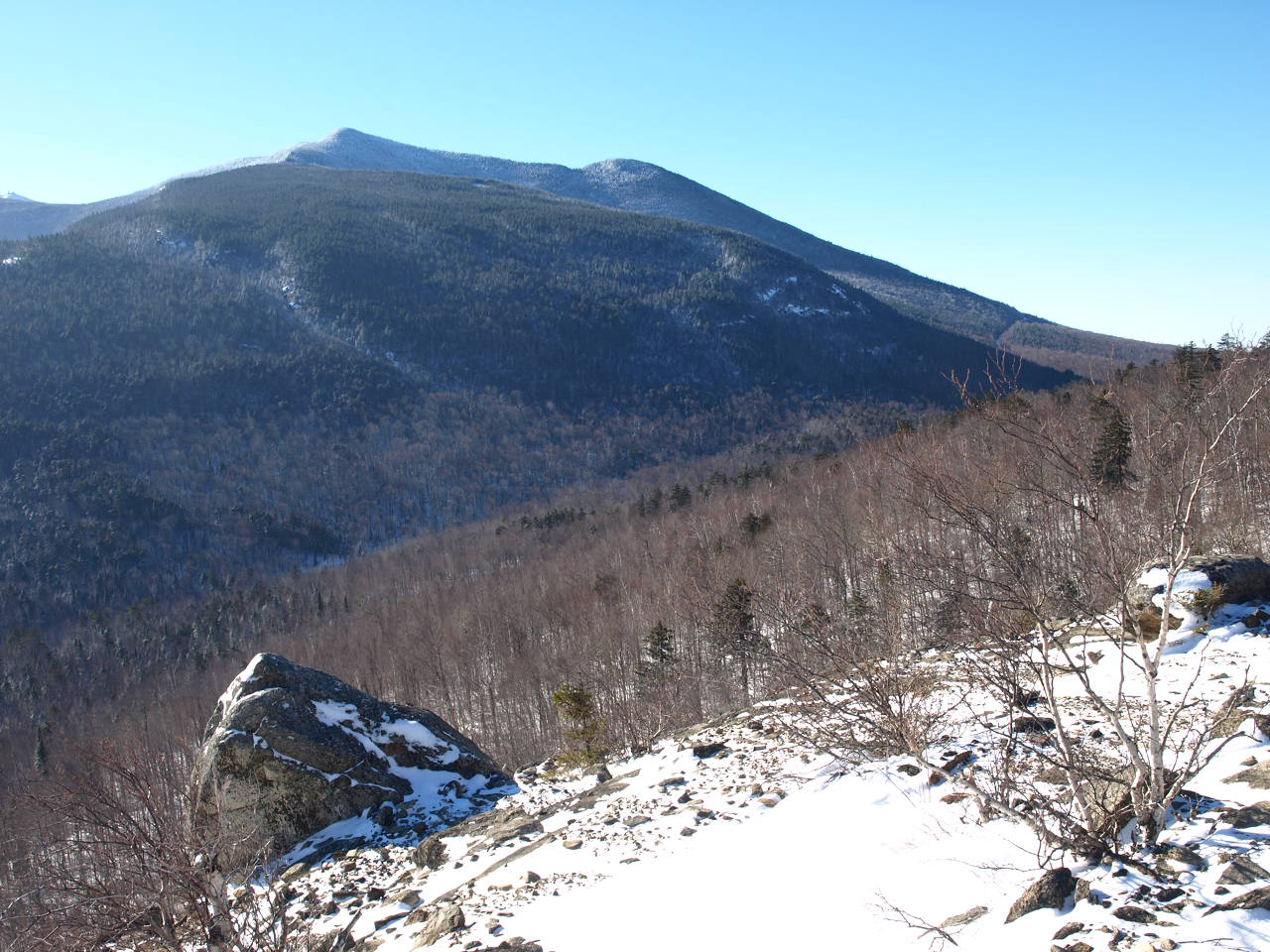
The summit of Cobble Lookout


It wasn’t long before I started the final approach to the ledge. I could see it through the trees as the trail widened through the conifers, and then I was there looking out over the rubbled top. There was not enough snow to cover the rocks and gravel that were there, making for an awkward walk on snowshoes. The wind was a bit bitter at times, but not too strong. I continued to walk along the edge to get additional views out toward the Jay Range, but the view of Esther and Whiteface in the forefront took most of my attention, what a unique perspective. It was now time for me to find the actual top of the Cobble that boasts this impressive ledge. My GPS gave the bearing and in about 60 seconds I was there. What? Were you expecting more? Actually the summit rests in the trees with a small 3-feet boulder resting on the top, no views from that spot – but who’s complaining?
The return to the car was very efficient. But where I usually call it a descent, this one actually felt more similar to an up. My round-trip was under 2 hours, even at a very relaxed pace with many stops to take pictures and a bit of time exploring the summit. With such a short distance and relatively non-existing climb, this is a perfect family destination for an interesting and highly rewarding snowshoe. Interested in heading on a family snowshoe hike or maybe you want to tackle Esther and Whiteface on snowshoes, give one of our local guide services a call for details. Need a place to stay while in the Whiteface Region? Book online and have your room waiting for you when you get here.
