About
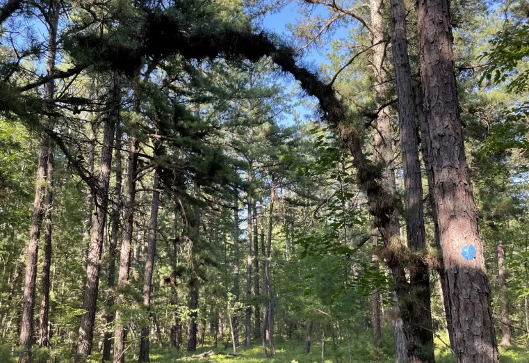
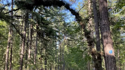
The Clintonville Pine Barrens is one of the rarest ecosystems in the Adirondack Park. The trail loops across a sand delta that was deposited 12,000 years ago by glaciers. This is a good option for taking a short walk while in Au Sable Forks.
Key takeaways
- Distance: 1 mile round trip
- Elevation gain: Around 15 feet
- Hike includes a trail junction
Hiking in the Clintonville Pine Barrens
The short lollipop loop can be done counterclockwise or clockwise. Hikers can expect a level trail that traverses the ancient sand delta. The terrain is defined by its well-drained, sandy soil and a canopy of pitch pines, offering a sunny and distinct walking environment that differs from much of the Adirondack forest types. Along the path, you’ll find a unique collection of fire-adapted flora, including low-growing blueberry and huckleberry shrubs, sweet fern, and wintergreen, making it an excellent spot for a quick, low-impact trek with high ecological interest.
In the winter
This trail is seldom done in the winter, but would be a nice snowshoe or xc ski. Parking is near the road, and may also not be plowed in the winter.
How to get there
From the light next to Stewart's in Au Sable Forms, drive on North Main Street about 0.1 miles to a stop sign. Continue straight at the stop sign onto Golf Course Roadm and follow for about two miles. Golf Course Road will take a right turn and become Dry Bridge Road. Travel on Dry Bridge Road for 0.2 miles, and then take the first left onto Buck Hill Road. The trailhead will be on your left in another 0.5 miles.
Accessibility Information


Packages and Promotions
range
Valid Jan. 29 - Jan. 31
Valid Jan. 28 - Feb. 1
Anniversary Giveaway at Small Town Spirits
Small Town Spirits & Wine
Small Town Spirits & Wine
Celebrate with Small Town Spirits all weekend long! Spend $20+ and be entered to win in our basket of cheer!
promotion
range
Valid Nov. 19 - Dec. 23
Valid Nov. 25 - Dec. 24
Jay Craft Center Annual Sale
Jay Craft Center
Jay Craft Center
Shop Local, Shop ADK! Discover one-of-a-kind, handcrafted gifts right here in the Adirondacks and find the perfect piece of art for your home or someone special.
promotion
range
Valid May. 2 - Oct. 25
Valid May. 2 - Oct. 25
High Falls Gorge Online Ticket Sales
High Falls Gorge
High Falls Gorge
High Falls Gorge, the Adirondacks' most stunning 30-minute walk around four waterfalls on the majestic Ausable River, is offering 10% off all summe
promotion
range
Valid Feb. 25 - Feb. 28
Valid Feb. 1 - Mar. 1
ADK Winter Pride Specials at NewVida Preserve
NewVida Preserve
NewVida Preserve
Celebrate Adirondack Winter Pride weekend in style at NewVida Preserve! They're turning up the energy with a featured cocktail that’s bold and vibrant: the Pink Pony Club.
promotion
range
Valid Nov. 22 - Nov. 25
Valid Nov. 19 - Nov. 25
Landscape Paintings Cider Sale!
Landscape Paintings Holiday Cider Sale. Buy 3 or more bottles and save $5/per bottle.
promotion
range
Valid Dec. 2 - Dec. 23
Valid Dec. 2 - Dec. 23
Christmas Special in Lake Placid
SHORT-TERM RENTAL PERMIT: STR-200259 Welcome to Cliff View Loj, a stunning Adirondack retreat offering privacy, space, and breathtaking views of Mt
package
Holidays, Mid-Week Discounts
range
Valid Nov. 21 - Dec. 20
Valid Nov. 24 - Dec. 21
Holiday Sale at Young’s Studio and Gallery
Young's Studio & Gallery
Young's Studio & Gallery
Browse the selection of pottery, unique yarn, books, and jewelry, perfect for bringing a piece of the Adirondacks home or gifting to a loved one!
promotion
recurring
Valid
Valid Nov. 20 - Dec. 18
weekly on Friday, Saturday and Sunday until December 21, 2025
Yuletide Family Weekend
Santa's Workshop - Temporarily Closed for Summer & Fall 2026
Santa's Workshop - Temporarily Closed for Summer & Fall 2026
Experience a family Christmas adventure at Santa's Workshop - North Pole, N.Y.! Designed primarily for families with children aged 2 to 10, this package guarantees quality family time with two memorable evenings and two full days of enchantment.
package
Holidays, Activities and Attractions
1
week
FR,SA,SU
FR
range
Valid Jan. 4 - Jan. 30
Valid Jan. 4 - Jan. 30
Small Town Spirits January Sale
Small Town Spirits & Wine
Small Town Spirits & Wine
The "New Year, New Sale" event runs throughout January, featuring tiered rewards and deep discounts.
promotion
range
Valid Apr. 30 - Oct. 30
Valid Apr. 30 - Oct. 30
NY Fiber Trail at Young's Studio & Gallery
Young's Studio & Gallery
Young's Studio & Gallery
Pick up your free passport for the NY Fiber Trail at Young's Studio & Gallery May 1-Oct 31, and discover a wide selection of yarns!
promotion
recurring
Valid
Valid Dec. 28 - Mar. 30
weekly on Wednesday, Thursday, Friday, Saturday and Sunday until March 31, 2026
Après Ski at NewVida Preserve
NewVida Preserve
NewVida Preserve
Visit NewVida Preserve for Après-Ski at Summit & Spice Wednesday–Sunday from 4:00p.m.-6:00p.m.
promotion
1
week
WE,TH,FR,SA,SU
WE
range
Valid Nov. 25 - Nov. 29
Valid Nov. 10 - Nov. 24
Thanksgiving in the Mountains
Sugar House Retreats
Sugar House Retreats
Spend Thanksgiving at Sugar House ADK Base Camp, a modern farmhouse offering stunning mountain views, a hot tub, and a game room, making it the perfect getaway for family and friends. Enjoy quality time together with various activities and a fully-equipped kitchen to create a memorable holiday feast.
package
Other
range
Valid Nov. 15
Valid Nov. 13 - Nov. 15
$25 Sunday Supper at Summit and Spice
Summit & Spice Restaurant at NewVida Preserve
Summit & Spice Restaurant at NewVida Preserve
Visit Summit and Spice in NewVida Preserve this Sunday, November 16, for the launch of their Blue Plate Special Sunday Dinner.
promotion