About
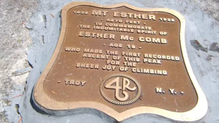
Esther was named after Esther McComb who, at the age of 15, made the first recorded ascent of the peak.
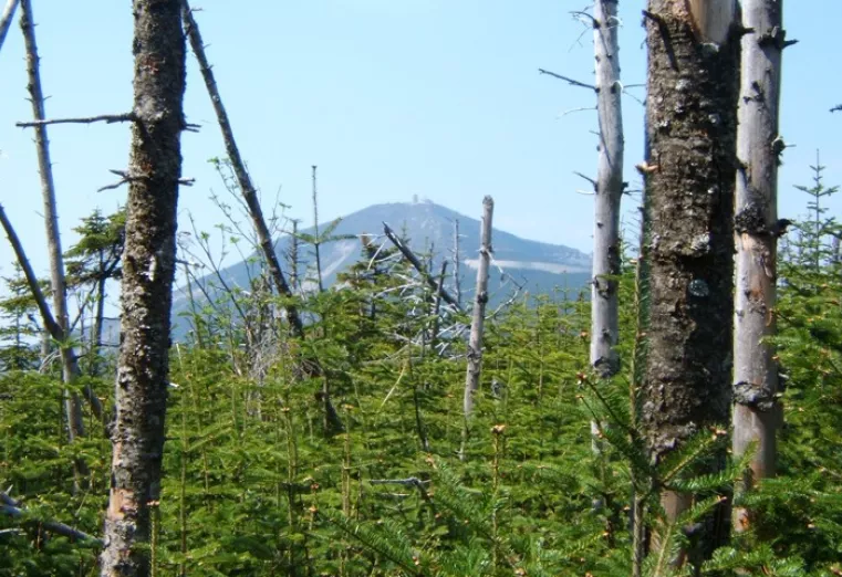
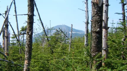
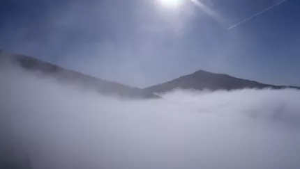
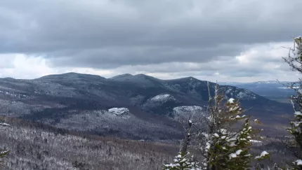
Esther is a High Peak located off the shoulder of Whiteface Mountain, a much bigger sister peak, and makes for an excellent and rewarding side trip on the way to climbing Whiteface. Esther is often climbed with Whiteface Mountain. There is no official path to Esther, but over the years, a herd path has developed. Of the 46 Adirondack High Peaks, Esther ranks number 28 and is the northern most High Peak.
Below are brief descriptions of the two major routes. We recommend you pick up a guide book and map for more in-depth detail or hire a local guide to assist you.
Hiking
Trail from the ASRC
This approach is the shortest, but that does not mean easiest. This is a High Peak, meaning there will be significant elevation gain and rugged terrain that brings you to one of the tallest mountains in New York.
Primary Trailhead: From the four-way stop sign in Wilmington, take the turn onto Route 431 (Whiteface Mountain Road) toward the Toll Road. Follow here, go 2.4 miles to the Atmospheric Science Research Center Road on the left. Follow this road around the one-way roundabout to the trail and parking on the right, just past a dirt road that descends into the woods. The trail is not labeled with a DEC sign.
From the trailhead you descend a bit to a very long and steep climb up Marble Mountain. The Marble Mountain section used to be an old ski slope and you will be able to see that in the old cement footers that still line the trail. Marble Mountain is rather steep and in the summer, if it's been dry, can have challenging footing. There are a lot of loose rocks and gravel.
From the top of Marble Mountain you will come to an intersection, left is the secondary trail outlined below. Right is the route you will want. After a short break on a flatter section you will start a demanding climb through an evergreen forest that opens up a few views along the way. After about 2.5 miles you will come to a rather large cairn at a trail intersection. This is the herd path to Esther Mountain, which has no official trail. Making a right onto the herd-path you will climb a bit to the summit of Lookout Mountain where you will have outstanding views to the north. From the summit of Lookout, you will descend for a while to a col between Lookout and Esther. The climb out of the col isn’t too dramatic, but tends to seem to drag on a bit before it reaches the summit. Be sure to not stop at the false summit prior to final push, this can be easy to do when visibility is poor.
There is a plaque on the summit in commemoration of Esther McComb.
Trail from the Reservoir
The approach intersects the trail the ASRC; the only difference is it is a bit longer. This route is used as often as the primary trail and offers a slightly easier grade but more elevation gain.
Secondary Trailhead: From the four-way stop sign in Wilmington, take the turn onto Route 431 (Whiteface Mountain Road) toward the Toll Road. Go 0.6 miles to Reservoir Road on the left, drive to the end and park.
From the trailhead you will hike through an attractive open forest along a well-trodden foot trail for 1.2 miles. For the most part, the grade isn’t too steep but it is very steady. It remains steady until the trail then swings right and up steeply to just below the summit of Marble Mountain at the intersection with the primary trail above. Read more on the primary trail above.
Snowshoeing
All three approaches can be accessed in winter. Once on the summit, there may be heavy winds and frigid temperatures. Proper winter attire and gear is critical here. Traction devices, such as snowshoes and spikes, are necessary to traverse the icy sections and deep snows. Once on the herd path for Esther, you will notice the trees become heavily weighted down from snow and make the passage quite narrow.
Accessibility Information
Visit Website
Email


Share to:
Additional Info
Esther Mountain trail map Whiteface and Esther Mountains trail map

Packages and Promotions
range
Valid Mar. 4 - Mar. 6
Valid Mar. 4 - Mar. 6
Sticker Sale at Whiteface!
Brookside Apparel
Brookside Apparel, Whiteface Mountain Ski Resort
20% off all stickers at Brookside Apparel and Flying Squirrel Apparel
promotion
Ski, Shopping Deals
range
Valid Mar. 7 - Mar. 13
Valid Mar. 4 - Mar. 13
Pin Sale at Whiteface!
Brookside Apparel
Brookside Apparel, Whiteface Mountain Ski Resort
20% off all Pins at Brookside Apparel and Flying Squirrel Apparel
promotion
Ski, Shopping Deals
range
Valid Apr. 11 - Apr. 30
Valid Mar. 4 - Apr. 30
Winter Clearance - 40% OFF!
Brookside Apparel
Brookside Apparel, Whiteface Mountain Ski Resort
40% Off Winter Merchandise
promotion
Ski, Shopping Deals
range
Valid Mar. 28 - Apr. 3
Valid Mar. 4 - Apr. 3
Winter Clearance at Whiteface!
Brookside Apparel
Brookside Apparel, Whiteface Mountain Ski Resort
40% off Select Items!
promotion
Ski, Shopping Deals